Calgary Commute Guide 2026: Driving vs. Taking the C-Train
[kvcoreidx_search]
Calgary Commute Guide
In Toronto, a “bad commute” means losing two hours of your life on the 401. In Vancouver, it means inching across the Lions Gate Bridge in the rain.
In Calgary, a “bad commute” usually means it took you 35 minutes instead of 20.
One of Calgary’s biggest selling points is that traffic actually moves. But as the city grows—and with massive construction projects like the Green Line LRT disrupting routes in 2026—knowing how to get around is more important than ever.
Here is your honest guide to navigating the Calgary commute in 2026, whether you are behind the wheel or riding the rails.
1. The Driving Reality: The “20-Minute City” Myth
Calgary was long known as the “20-minute city,” meaning you could get anywhere in 20 minutes. In 2026, that is officially dead. It is now the “30-to-40-minute city” during rush hour.
The Big Three Arteries
- Deerfoot Trail (Hwy 2): The spine of the city. It runs North-South and is notoriously volatile.
- The Bottleneck: The stretch between Glenmore Trail and Memorial Drive is a parking lot from 7:30 AM to 9:00 AM and 3:30 PM to 5:30 PM.
- Winter Warning: Black ice on the bridges (especially over the Bow River) causes daily accidents in winter.
- Crowchild Trail: The main route for the West and North-West. It flows reasonably well until you hit the bridge over the Bow River, which funnels three lanes into chaos.
- Stoney Trail (The Ring Road): Now fully completed, this is a commuter’s dream for avoiding the core. If you live in deep suburbs like Seton or Evanston and work in a different quadrant, take Stoney. It adds kilometers but saves sanity.
Parking Costs
If you work downtown, prepare your wallet. Calgary has some of the highest downtown parking rates in North America.
- Daily Rate: $25 – $40
- Monthly Unreserved: $350 – $500
- Pro Tip: Many commuters park at C-Train stations (Park and Ride) for free or a low monthly fee, then take the train the final 15 minutes.
High-net-worth professionals can completely eliminate the stress of traffic by strategically living in Calgary’s best neighbourhoods for executive homes that offer direct, rapid access to the downtown corporate sector. To strike the perfect balance between minimizing your daily transit time and securing a premium school zone, every working parent should review our moving to Calgary with family relocation guide.
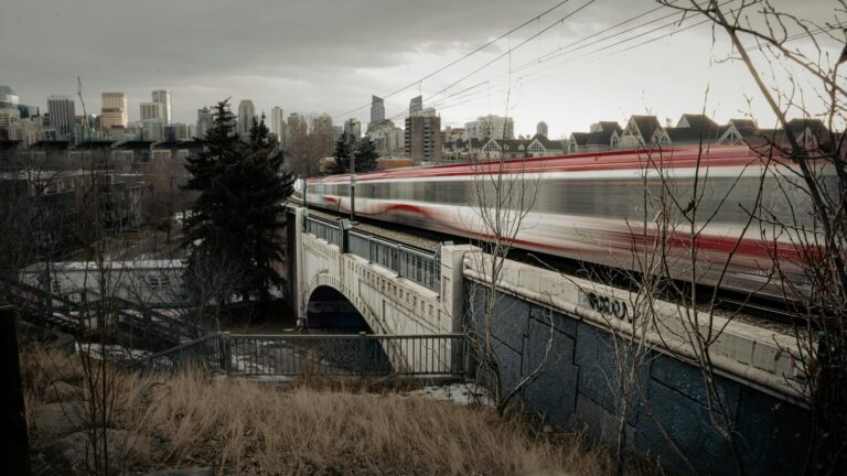
2. The Public Transit Alternative: The C-Train
Calgary’s Light Rail Transit (LRT) is efficient, wind-powered, and (mostly) reliable. For retirees who want absolute maximum walkability and direct CTrain access without sacrificing a private yard, securing a property by downsizing in Calgary bungalow communities near the core is the ultimate lifestyle upgrade.
The Network
- Red Line: Runs Northwest (Tuscany/University) to South (Somerset-Bridlewood).
- Blue Line: Runs Northeast (Saddletowne) to West (69th St).
- The Green Line (Under Construction): In 2026, you will see massive construction barriers along the Southeast corridor and through the Beltline. It is not running yet, but it is causing traffic delays for drivers in Ogdon and Inglewood.
2026 Fares & Safety
- Cost: A single adult ride is $4.00, and a monthly pass is $126.
- Free Fare Zone: The train is free between City Hall and Downtown West/Kerby stations. This is great for hopping between meetings downtown.
- Safety: After a rough patch in 2023-2024, safety has improved with increased peace officer patrols and upgraded lighting at stations, though late-night ridership still requires vigilance.
Many aggressive commuters opt for high-density apartments directly adjacent to major CTrain hubs, making it critical to fully understand Calgary condo fees and their average cost before finalizing your transit-friendly purchase.
3. Quadrant-by-Quadrant Commute Guide
North West (NW)
- Communities: Tuscany, Crowfoot, Brentwood.
- The Commute: Excellent C-Train access (Red Line). Crowchild Trail is steady but reliable.
- Verdict: Best for downtown workers who want a predictable 25-minute train ride.
North East (NE)
- Communities: Saddleridge, Taradale.
- The Commute: Heavy reliance on the Blue Line. Driving involves Deerfoot Trail, which is stressful.
- Verdict: Great transit access, but driving can be a grind due to heavy industrial traffic near the Airport.
South West (SW)
- Communities: Aspen Woods, Signal Hill.
- The Commute: The Blue Line ends at 69th Street, so deep SW communities rely on Bow Trail (driving).
- Verdict: A wealthy quadrant with a “driving first” culture. Bow Trail is busy but moves better than Deerfoot.
South East (SE)
- Communities: McKenzie Towne, Mahogany, Seton.
- The Commute: The toughest in the city right now. There is no C-Train line yet (Green Line is coming). You are 100% reliant on Deerfoot Trail or 52nd Street.
- Verdict: Expect a 45-50 minute drive to downtown in rush hour. However, if you work in the industrial parks or Foothills, it’s perfect.
Calgary Commute FAQs
Contact us to get our “Commuter Map” showing which communities have the best Park & Ride lots.
Is the C-Train safe at night?
It has improved significantly in 2026. The city has deployed more safety officers and “transit ambassadors”. However, like any major city, stay alert, ride in the lead car (near the driver), and use the designated “safety zones” on platforms if waiting alone after 9 PM.
Do I really need a car in Calgary?
Unless you live and work directly on the C-Train line (e.g., live in Brentwood, work downtown), yes. Calgary is sprawling. Grocery runs, visiting friends, and getting to the mountains are extremely difficult without a vehicle.
How bad is the Green Line construction traffic?
In 2026, it is noticeable in the Beltline and Southeast (Ogden/Inglewood). Lane closures are frequent. If you commute from the SE, check Google Maps every morning—routes that worked yesterday might be closed today.
What are “reversible lanes”?
On Memorial Drive and Centre Street Bridge, lanes reverse direction based on rush hour (inbound in the morning, outbound in the afternoon). Watch the overhead digital X’s and arrows carefully—driving in the wrong lane is a fast way to cause a head-on collision.
Can I cycle to work?
Yes! Calgary has one of the most extensive pathway networks in North America. The Bow River Pathway is plowed in winter, and downtown has separated bike lanes. If you are tough enough for the cold (or have a fat tire bike), you can cycle year-round.